10th century Arab geographer about Armenian carpets, silk and dye “vordan karmir”
In the 29th issue for the year 1901 of the project “The Collection of Materials to Describe the Terrain and Tribes in the Caucasus,” N. A. Karaulov published a study titled “Arabian writers’ data about the Caucasus, Armenia and Aderbeijan. Part 1. Al Istakhri.” The merit of Karaulov’s work is that he publishes a full translation of the 10th century Arab geographer Al Istakhri’s “Book of Roads and Kingdoms” attaching also the original in Arabic and giving some information about the authors and their work.
Beginning
Tiflis was a city smaller than Bab-ul-Abwab in sizes. There were two clay walls around it with three gates. This city was quite prosperous and rich in fields and crops. It was a border city and had baths, like those in Tabaristan, with water, which was hot without the help of fire.
“There are no cities more prominent than Berda’a, Bab-ul-Abwab and Tiflis. Baylaqan, Barsan, Berdild, Berzenj, Al-Shamakhiya, Sharavan, Abkhaz, Shabaran, Qabala, Shakki, Janza and Shamkur and Khunan are minor towns of equal sizes, but they are prosperous and abound in lands,” Al Istakhri writes finishing the description of the cities in Arran.
Next, Al Istakhri describes Armenia. Dabil (Dvin, a city not far from Yerevan) was larger than Ardabil. This city used to be the capital of Armenia and it had a ruler’s palace like Arran ruler’s palace in Berda’a and Aderbeijan’s palace in Ardabil.
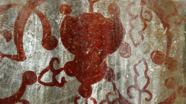
There were many Christians in the city. Wool dresses and carpets, pillows, seats, cords and other items of Armenian production were made there. They obtained dye, called “kirmiz” (“vordan karmir” – ed.), and used it to paint cloths. “I learnt that it is a worm that spins around itself like a silkworm. Besides, I learnt that a lot of silk products are manufactured there,” Al Istakhri writes.
Demarcating Armenia, Al Istakhri writes that it bordered with Rum and its boundaries reached Berda’a, Jazira and Aderbeijan. The area of Armenia bordering Rum was called Kalikala. Tribes from Aderbeijan, Jibal, Rey and their neighbor countries raided Armenia. They had a place known by the name “Trabezunde” whence they entered Rum. Merchants gathered there and then took their way to Rum for trade. Hence, anything made of brocade, silk and clothes from Rum that reached these countries were brought from Trabezunde.
The geographer further lists the cities and settlements in Armenia: Nashava (Nakhijevan), Berkeri, Khilat, Manazkird, Badlis, Kalikala, Arzan (Erzrum), Mayafarikin and Siraj, all minor in sizes yet prosperous and with rich population.
“Mayafarikin is considered to belong to Jazira, if one does not pay attention to the fact that it lies on the other side of Tigris, and Tigris serves as Jazira’s border. We mentioned this when describing the areas between Tigris and Euphrates. That is why we attach Mayafarikin to Armenia,” Al Istakhri explains.
Next, he describes the navigable rivers in the region, namely Kura, ar-Ras, and Sabidrud, flowing between Ardabil and Zanjan, as well as the River Samur, which flows in the country of the Lakzes.
As for the seas of Armenia, Arran and Aderbeijan, the author writes that there was a lake in Aderbeijan called Urmia, and another lake in Armenia, called “lake Arjish” (Van).
Al Istakhri also demarcates the borders of Arran and Aderbeijan: Arran’s borders stretched from Bab-ul-Abwab to Tiflis and a place known by the name “Khajiran” (Nakhijevan), near the river ar-Ras. Aderbeijan’s border: a mountain range reaching the farthest borders of Tarma and Zanjan, then it touched the farthest borders of Dinaver until it neared Tigris, and then encircled the boundaries of Armenia.
To be continued.
“The Collection of Materials to Describe the Terrain and Tribes in the Caucasus” is a large-scale publication of narrative sources carried out by the management of the Caucasus Educational Okrug in 1881-1908. It includes researches and description of the history, life, and ethnographic characteristics of the peoples inhabiting the Caucasus region of the Russian Empire.
Related:
C10th Arab geographer about Armenia and gates of Derbent protecting region from Turks
Scientific publication of Russian Empire about destruction of Christian monuments in Barda by Tatars
Scientific publication recounts historical data about C15th Armenian village Kusapat in Artsakh
Scientific edition of Russian Empire: Nakhijevan was prominent Armenian city founded in C16 BC
Newsfeed
Videos


