Rouben Galichian: Authorities and scholars in Azerbaijan try to deny and falsify commonly known facts
On the Emperor Peter the Great’s order, the French cartographer Guillaume Delisle (1675-1726) measured the shores of the Caspian Sea and compiled a modern topographic map. Atlas Russicus (the Russian Atlas) was the result of his works and showed the Caspian and Black Seas and the territory between them. In his book Historical and Geographical Falsifications of Azerbaijan, a historical, cultural and cartographical research based on a detailed analysis backed by documentary evidence, famous cartographer Rouben Galichian analyses the maps compiled by Delisle and others.
In the detail of the map shown in Galichian’s book, the lands of Armenia, Atrpatakan and former Aghvank can be seen. Muslim khanates under the Persian rule are shown in the territory of the latter. The name Aghvank is not to be found on the map, Aderbijan (Atrpatakan), the Iranian province of Azerbaijan, is situated on the southern bank of the river Araks, Galichian writes.
According to Delisle’s map, the khanates of Shamakhi and Derbend, coloured in red, are situated in the territory of the modern Azerbaijani Republic under the common name Shirvan. Armenia is coloured green and is located to the left from the centre, stretching from the Western Armenia almost to Kapan.
“This eighteenth-century Russian-French map also proves what the others did – that the Republic of Azerbaijan, founded in 1918, and the name, copied with precision from that of the north-western province of Iran, occupied the territory of the khanates of Shamakhi and Shirvan,” Galichian writes.
Next, he presents a detail of a map of the Ottoman Empire, compiled by Johann Baptist Homann (1663-1724). It is taken from his Atlas Novus (New Atlas), published in St Petersburg in 1748. The map including Armenia and the neighbouring lands, Armenia is placed on both sides of the Araks. Adherbeizan (Atrpatakan) is shown on the southern bank of the Araks, to the east. Bakou (Baku), Schamakhie and Derbend are situated to the north of the river Kura, all in the territory named Schirwan. Dagestan is placed to the north of them.
“That German map, like the others, clearly shows that Shirwan is the territory of the ancient Aghvank, situated to the north of the Araks and Kura, while Azerbaijan is the Iranian province of Atrpatakan located to the south of Araks. There are no ‘Northern’ and ‘Southern’ Azerbaijans, invented by the Azerbaijani historians, mentioned either on this map, or on all the ancient ones,” Galichian highlights.
The map The Ancient Monarchies of the World by M. Robert was created in Paris in 1779. Among the monarchies in question, are those of Greater Armenia and its neighbouring countries Albania (Aghvank), Media, Parthia, Iberia and Media-Atropatene (Adrbejan). As in all other maps, Aghvank is situated north of Kura, while Atropatena-Azerbaijan has no divisions into ‘Northern’ and ‘Southern’ on this map of 1779.
The Russian map titled ‘Asiatic Turkey, Anatolia, including Armenia, Kurdistan, Aljazeera and IraqAjami’ from the New Atlas, or Collection of Maps of all the Corners of the World printed in St Petersburg in 1793, shows Armenia divided between the Ottoman and Russian empires. Major Armenian cities here are Yerevan, Arabkir, Kars, Van, Bitlis, Baiburt and Khlat. “The land lying to the east of Armenia and to the north of the Kura, where the present-day Republic of Azerbaijan is situated, is named Shirvan, within which are the cities of Baku and Derbend. The cities in Atrpatakan – Maragha, Tabriz and Ardabil – are located within the borders of Iran,” Galcihian writes.
He next presents a map of the Caspian Sea, Armenia, Dagestan and Shirvan, compiled by German military Marshal von Bieberstein and published in 1800. It is titled ‘Sketch of the Lands Between the rivers Kura and Terek Near the Caspian Sea.’
According to the description, the lower part of the map shows the river Araks, which joins the Kura and flows into the Caspian Sea. Schamakhie Khanate is situated to the north of the Kura, and Shaki, Derbend and Tabasaran are further north of it. They are all commonly referred to as Shirvan. “This name corresponds to the ones given by Delisle, Minorsky, Bakikhanov and others, that is to say, to the region coinciding with the territory of the historical Aghvank Proper [Boun Aghvank]. There are no names ‘Azerbaijan’ or ‘Aghvank,’ as the former is situated to the south of Araks, out of the scope of the map, and the latter has already yielded its place to the above-mentioned khanates on a historical scene,” Galichian writes and notes that the Republic of Azerbaijan, founded in 1918, occupied that very region.
Galichian also writes about a map by William Faden (1750-1836) titled Asiatic Turkey and taken from the World Atlas published in Skutari (a district in Constantinople) in 1803-1804. This, in its turn, was based on Faden’s General Atlas published in London in 1778. “From the 52 maps of the English-language atlas, only 24 were included in the Turkish one, translated by Mahmud Raif. The maps are big, meticulously prepared and coloured. The atlas dates from 1218 AH (Anno Hegirae) and has 78 pages of descriptive texts about the Earth, the Sun and the Moon, as well as the peoples. There are also descriptions of various countries and important cities,” he writes.
The map shows the eastern borders of the Ottoman Empire, Armenia is divided into it and Persia. In particular, the map shows the names of some historical areas of Armenia – Revan (Yerevan) and Ararat within the Persian borders. The region of Erzrum and Van is named Ermenistan (Armenia).
“Azerbaijan is noted as a province in Persia on this map, as well. The name ‘Aghvank’ is not to be found on the map, neither is ‘Northern’ or ‘Southern’ Azerbaijan,” he writes.
Another map, created by Conrad Malte-Brun (1775-1826) and titled ‘Asiatic part of the Ottoman Empire,’ is taken from his Atlas Complet published in Paris in 1812. It shows Western and Eastern Armenia separately within their historical boundaries. Names of some of their regions are mentioned on the map. Eastern, or Russian, Armenia is shown on the territory stretching from Yerevan to Shushi under the rule of Iran.
the region North of the Kura is named Chyrvan (Shirvan) and further north, Daghistan. In Shirvan, the cities of Chamakhiyeh (Shamakhi), Sheki and Bakou are mentioned, which now are in the territory of the Republic of Azerbaijan. Derbend is situated in Dagestan. Atrpatakan is referred to Azerbaijan here and is situated on the southern bank Of the river Araks within Media (or Persia). The maps include some topographic information about the region.
Next, Galichian refers to a map taken from Atlas Antiquus by Karl von Spruner (1806-1892), a German geographer and specialist of ancient maps. It shows the territories lying to the south of the Caucasus and stretching to Mesopotamia in the period of Early Middle Ages. Colchis, Iberia (Georgia), Albania (Aghvank) are situated immediately to the south of the Caucasus. Armenia is south of them; Mesopotamia and Assyria are further south. Media-Atropatene and Media Parva (Media Minor) are situated to the south-east of Armenia. “There is no mention about the two separate Azerbaijans, ‘Northern’ and ‘Southern,’ on this map, either. Media-Atrpatakan is shown in the territory of the so-called ‘Southern Azerbaijan’,” Galichian writes.
On the Ottoman War Map (1877) of the Russo-Ottoman war, the territories between the river Araks and Yerznka are referred to as Ermenistan (Armenia), written in Turkish with Arabic script. The lands located to the north of the Kura are noted as Shirvan and include the towns of Baku and Shamakhi. Dagestan with the city Derbend is shown to the north of the Caucasus. The land Karadagh is shown to the north of Iran, and the region is mistakenly named Azerenjan instead of Azerbaijan. “This is one of the last Ottoman maps to show the name of Armenia on all the Armenian lands. On the same map, the territory of the Republic of Azerbaijan is not named Azerbaijan or Aghvank, but Shirvan. This map shows only one Azerbaijan, which is the Persian province,” Galichian writes.
Two maps, compiled by famous 19th-century cartographers Carl (Charles) Muller (1813-1894) and Heinrich Kiepert (1818-1899), are of certain interest, according to Galichian. These maps show the countries of the Middle and Near East during the times of Alexander the Great and Tigranes the Great. Kiepert’s map of the territories of the Ancient World conquered by Alexander the Great shows the following ancient states among the conquered and neighbouring countries:
Armenia, situated on the two banks of the river Araks and around the Lake Van, from Malatya to Lake Sevan;
Media, south of Araks, not yet been renamed Atrpatakan;
Albania, or Aghvank Proper [Boun Aghvank], situated on the lands lying to the north of the river Kura.
Muller’s map shows the Ancient World in the times of Mithridates VI Eupator (134-63 BC), which also coincides with the reign (95-55 BC) of Tigranes the Great of Armenia (140-55 BC). On the map, the areas conquered by Tigranes the Great stretch to the Kura, and Media-Atropatene is placed to the south-east of them, on the southern side of the river Araks. Albania, Aghvank Proper, is located on the northern banks of the Kura.
This means, that the Ancient World looks the following way on the maps compiled by the cartographers from across the world: Aghvank was situated on the lands to the north of the Kura and Araks; Atrpatakan-Azerbaijan was located to the south of the Araks and was a separate region; Armenia was a third country neighbouring them. The territory lying to the north of the Araks has never been called Azerbaijan.
“Meanwhile, the authorities and the scientific circles in Azerbaijan are trying to completely deny and falsify those commonly known facts today,” Galichian sums up.
To be continued.
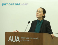
Born in Tabriz, Rouben Galichian is a descendant of refugees from Van who survived the Genocide. He received scholarship and studied engineering at Aston University, Birmingham (UK). Since in 1981, he started to study the rich cartographical heritage in the libraries of the UK and other European countries. His first research, Historic Maps of Armenia (in English), was published in 2004. It was a collection of maps from various libraries and museums in the world, where Armenia was noted, beginning from the 6th century to the present times. His second book, Armenia in World Cartography, was published in Yerevan in 2005. The research ‘Countries South of the Caucasus in Medieval Maps. Armenia, Georgia and Azerbaijan’ (in English and Armenian) was published in 2007. The book The Invention of History (in English) was published in 2009.
In his book Historical and Geographical Falsifications of Azerbaijan, published in 2013, the author details the reasons, aims and methodology of the falsification of the history of Azerbaijan and the countries of the region.
Related news
- Rouben Galichian: Medieval maps rule out Azerbaijan’s existence allegedly to north of Araks
- Rouben Galichian: Prominent medieval Ebstorf Map has 4 mentions about Armenia and none about Azerbaijan
- Rouben Galichian notes peculiarities of medieval Christian and Islamic Cartography and Azerbaijan’s absence on maps
- Rouben Galichian: Armenia and South Caucasus in early medieval cartographers’ works
Newsfeed
Videos


